
Top Walks
Slow down and take the scenic route as you explore some of the Hutt Valley’s best walks.
From quick riverside strolls to longer bush tracks and hilltop lookouts, there’s a walk to suit everyone.
LOCAL TIP: It’s exposed at the top! Bring a layer and take your time with the view.
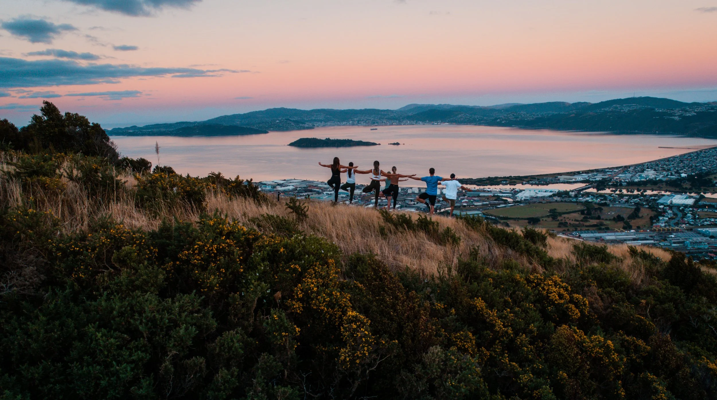
Te Whiti Riser
Te Whiti Riser is an easy 4km walk or ride to the top of the Eastern Hills from Te Whiti Park. Park your car opposite 197 Riverside Drive and begin your adventure.
The track passes through a mix of vegetation, opening out to wide views across the Hutt Valley. Look out for the boardwalk sections along the way, it’s a steady, well-formed climb.
It’s a family-friendly 8km return from Te Whiti Park, or you can venture further along the ridge-top trails starting at the summit.
GETTING THERE:Opposite 197 Riverside Drive, Lower Hutt (Te Whiti Park access).
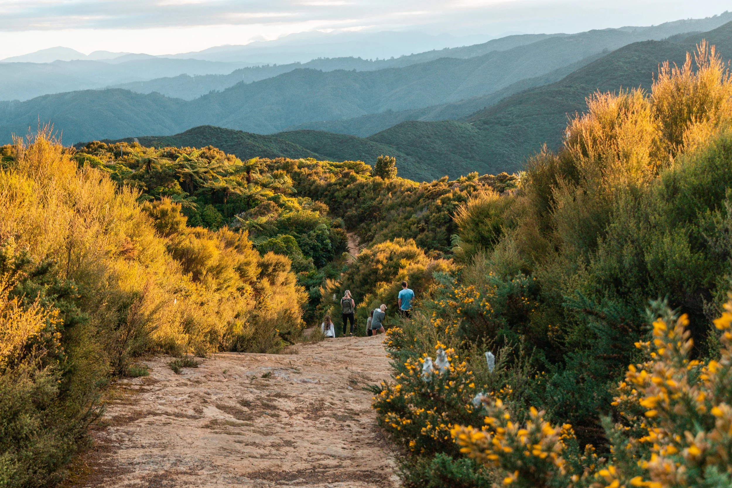
Orongorongo Track
The Orongorongo Track is a well-formed 5km walk through native bush, leading down to the Orongorongo River.
Starting from Catchpool Valley, the track follows a wide, gradual path through beech forest, making it a popular option for walkers, runners, and mountain bikers.
It’s a 10km return track (around 1.5–2 hours each way). At the bottom, you’ll reach the river an easy spot to stop, reset, and take it in before heading back.
GETTING THERE: Head through Wainuiomata and follow Coast Road for around 10km to the Remutaka Forest Park entrance. From there, it’s a further 2km along Catchpool Valley Road to the main car park and start of the track.


LOCAL TIP: The return is all uphill, don’t go too hard on the way down.

LOCAL TIP: It’s all uphill on the way, in take it steady and enjoy the quiet.
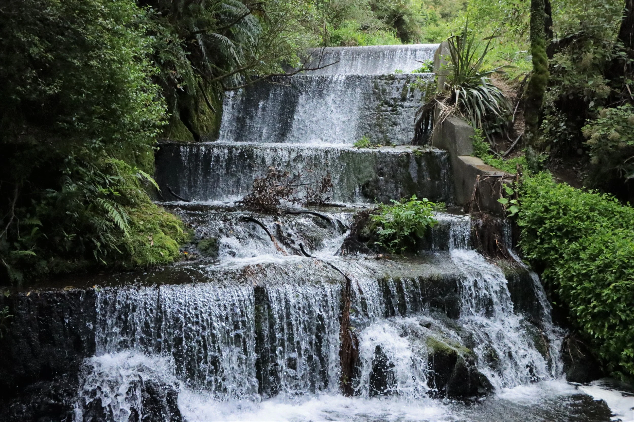
Belmont Regional Park
Follow an old water pipeline upstream through mature bush to Korokoro Dam — the first gravity-fed concrete dam in New Zealand, built in 1903.
The track is a steady climb through native bush, opening up to this unexpected historic spot tucked into the hills.
Moderate, around 3 hours return.
GETTING THERE: Cornish Street entrance, Petone (about a 10-minute walk from Petone Railway Station).
Baring Head
Wide open coastal views, rugged cliffs and the sound of waves crashing below make Baring Head Lighthouse feel a world away from the city.
The walk follows a mostly flat gravel track out to the historic lighthouse, with sweeping views across the Cook Strait and plenty of spots to stop along the way. Keep an eye out for seals sunbathing on the rocks below.
Easy to moderate, around a 1.5–2 hour return walk.
GETTING THERE: Access from the carpark at the end of Coast Road, Wainuiomata.

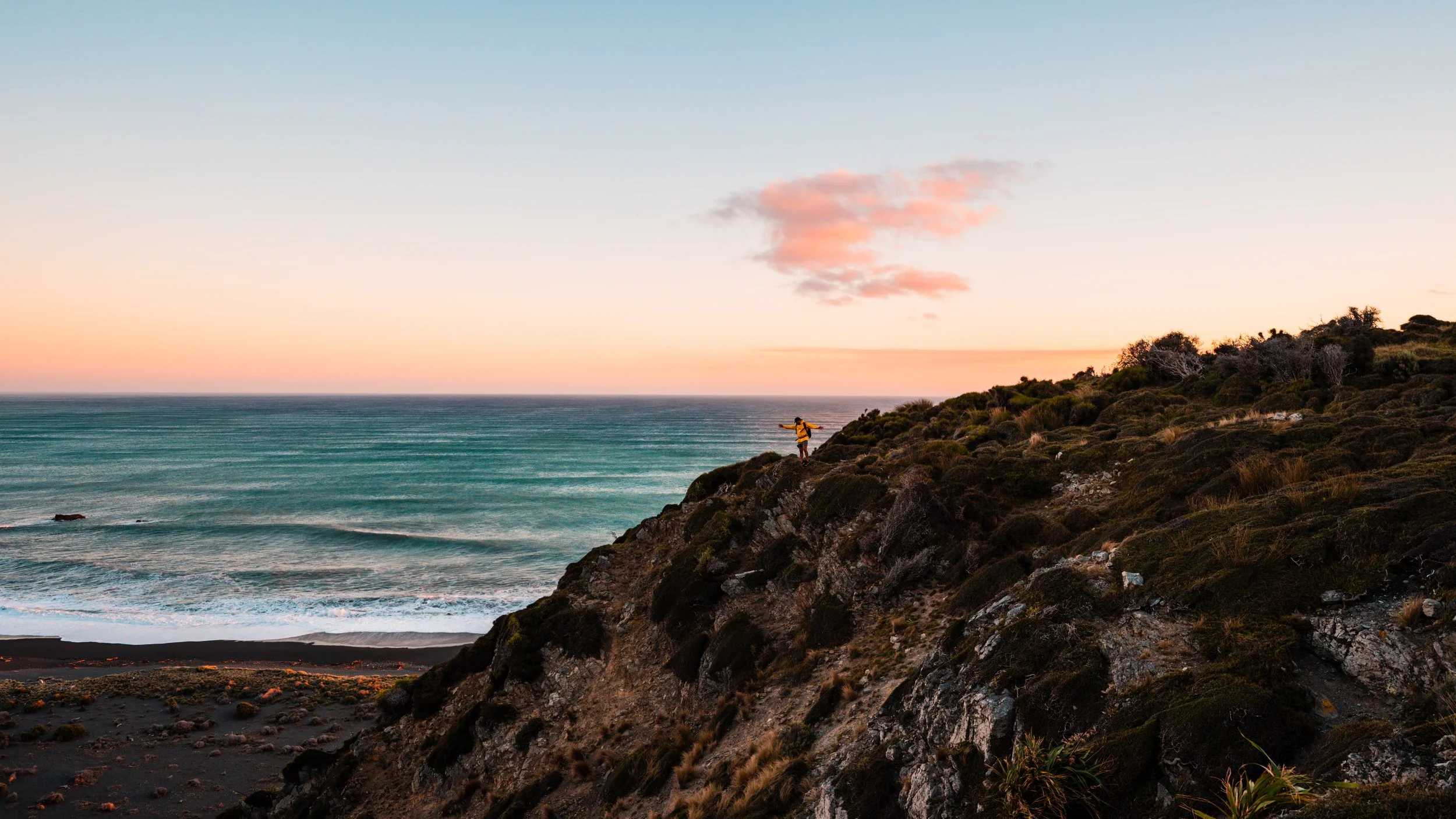
LOCAL TIP: pick a clear day and head out later in the afternoon, the sunset views out here are pretty hard to beat.
Butterfly Creek
A short, sharp zig-zag climb from Kowhai Street is the quickest way to Butterfly Creek Orongorongo Track, and the views over Wellington Harbour more than make up for it.
Along the way, you’ll pass through native bush with towering rimu and beech trees before reaching an open space that’s perfect for a break.
Short but steep.
GETTING THERE: Kowhai Street, Eastbourne. The track entrance is at the end of the road.

LOCAL TIP: Pack a picnic, you’ll want to stop at the top.